Field Observations:
Contributed by Aykut Barka
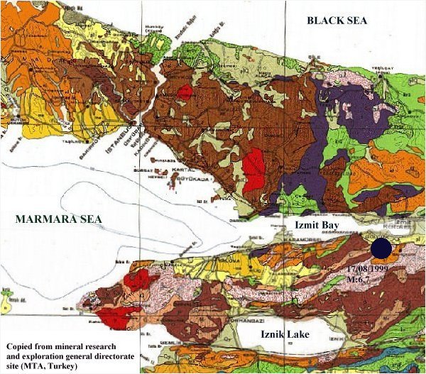
Field observations indicate two rupture segments between sakarya river and Golcuk as indicated on the figure. The total obsevable length of the rupture is about 50km. The lateral offsets vary between 1.9 and 3m. In this section of the North anatolian Fault the previous important ruptures were in 1719 and 1754. The current rate of deformation (prior to the earthquake) was about 10ᆣmm/year as revealed by the GPS measurements.
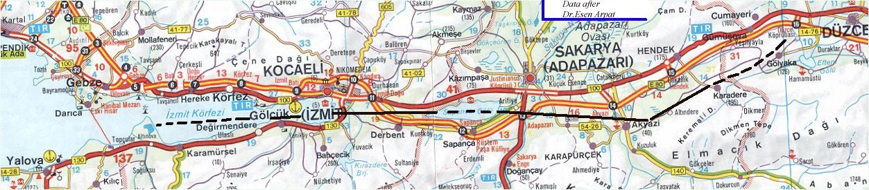
Contributed by Esen Arpat and Dogan Kalafat
Between Hereke and Izmit
Damage is higher between the Korfez and Derince ares. However no fault rupture was observed in this area in-line with our expectations from the geology. The building damage decreases as we go east towards the Izmit area.
Between Izmit and West of Sapanca Lake
Right-Lateral rupture of the main fault is observed in perfect correspondence with the previously mapped features. The lateral offset varies between 230 and 260cm. Although local subsidence are evident there does not exist any systematic dipping motion. As is typical for such shear zones, Reidel fractures, P fractures and en-echelon fractures are common. Such features are evident on the railroad tracks near Tepetarla station.
Between East of Sapanca Lake and Arifiye
After passing through the Sapanca lake the fault rupture can be followed on-shore towards Arifiye. However the offsets decrease to 150cm. In this region there exist large compression deformations on the highway for about 1km length of the road. The collapsed overpass bridge at Arifiye is also located in this zone.